Showing posts with label North Platte Nebraska. Show all posts

Wednesday, February 4, 2015

May 10, 1926: A Newly Established Great Plains Highway Association Clamors for a North-to-South Road


Look for the new book Feb. 9!
“The peppiest bunch of good road enthusiasts ever assembled in southwestern Nebraska is now within our gates—and they will not be denied their goal—a state-federal highway from Canada to the Gulf, running more or less north-south through McCook,” said the evening edition of the McCook Gazette.
It was the May 10, 1926, when some 200 businessmen from South Dakota, Nebraska, Kansas and Texas converged at the Keystone Hotel in McCook, Nebraska, to put together the Great Plains Highway Association.
The Good Roads Movement was in full swing and about to have its greatest success. Local and national associations for decades had come together to create auto trails that would connect their towns. It was an alliance between corporations who had a vested interest in promoting car travel—automobile, tire, cement manufacturers—and local businessmen who wanted the same. By 1923, Ford was cranking out more than 2 million Model Ts per year. Motorists were clamoring for better driving conditions.
Such associations had been popping up everywhere. The Lincoln Highway was the first transcontinental road. The Bankhead was the second, but took a more southerly route.
Between cities and small towns, there was little in the way of actual roads, just ruts in the mud. Some of these associations made logos they put on signs to help guide motorists. Many of the trails converged and associations competed to draw motorists to their trails. 
By 1926, there were some 250 named trails in the United States. Many of them were aspirations—just lines on a map with no real backing or improved roads.
The Good Roads Movement’s ultimate goal was to cajole the federal government into doing more to build highways. And in that, it had already succeeded by 1926. The American Association of State Highway Officials, with the blessing of the federal government, had already released its draft proposal of numbered highways and their routes. The committee tasked with creating the new system had long decided to do away with named auto trails. The descriptive, colorful names—the Dixie Highway, the Blue Pole Highway, the Pikes Peak Ocean-to-Ocean Highway—would not be official names.
The final list would be released in November, and it would mark the beginning of the state and federal partnership to standardize roads in America, the Good Roads Movement’s ultimate goal. The logos would soon be replaced by the federal shield sign still in use today.
That was undoubtedly known by most of those attending, but it didn’t damper their enthusiasm for a Great Plains, north-to-south highway. At that point, there were no highways going north to south between Kansas City and Denver. The closest was the Meridian Highway, which hugged the state lines to the east (present day U.S. 81). McCook good road promoters had succeeded two decades ago helping to develop the O.L.D (Omaha Lincoln Denver) trail across the bottom half of the state. By 1926, it had expanded to the D.L.D., the Detroit-Lincoln-Denver trail.
The businessmen came together in the afternoon to adopt a constitution and bylaws and to elect officers. The president would be Charles O. Woods of North Platte; vice president, A.B. Whitney of Murdo, South Dakota and the secretary-treasurer was V. Barbazette of McCook.
One by one the attendees stood up to add their support to the growing chorus of those who thought there needed to be a north-to-south road. When it came to highways, the country was still following in the footsteps of the Conestoga wagons on their east-to-west journeys. When the first draft of what would be the federal highway was released in 1925, there were no north-south roads in the middle of North Dakota, South Dakota, Nebraska and Kansas. That could not have sat well with the citizens of Minot, Bismarck, Pierre, North Platte, McCook, Oberlin, Garden City and Liberal.
Connecting the prairielands to the ports in South Texas was one of the new association’s stated goals.
The guest of honor at the meeting was Nebraska State Engineer Roy Cochran. Nebraska had already put in place a taxation system that favored the sparsely populated part of the state. Some $1.5 million had already been spent improving the road between North Platte and McCook, he said. From North Platte to Valentine, the heart of the foreboding Sand Hills, there was almost nothing, he said. The state was bogged down in the sandy soil as the Blue Pole Highway— a Fremont to Chadron east-to-west road—stretched westwards. Only 25 miles had been completed in two years in Cherry County.  
“The construction difficulties and the expense is so great that the progress has been quite slow,” Cochran said. The fact remained, that most commerce was still moving east to west, he told the audience. Nevertheless, he endorsed the idea of a north-to-south road as long as funding was available.
Some of the largest contingents at the meeting had come from the Sand Hills—towns such as Stapleton, Gandy, Tryon, Thedford and Brownlee—to lend their voices. Forty of the delegates came from Stapleton alone. The Sandhillers were a gloomy, pessimistic bunch, according to their dire warnings about road building in the dunes. Years of trying to traverse them had no doubt left psychological scars.
John Turner of Thedford had been trying to develop an east-to-west  “Potash Highway” (present day State Highway 2) for years, but to no avail.
“If you take a trip through the Sand Hills you will be surprised at [the] roads because there are none,” he said. He warned about the terrible, shifting sands.
“For God’s sake, give us a road,” he said.
A Mr. Christensen of Valentine did his best to dispel his town’s Wild West reputation  as he encouraged delegates to visit his fine city.
“We don’t have so many saloons and not nearly so much gambling…We want you to come up there fishing I will show you that if you come up there fishing you will get some fish,” he said.
“When I came down here today I was tired and a little bit discouraged until I saw all these men and I am very much enthused about this road and I am going back to Valentine very glad I came down.”
A Valentine to North Platte road tentatively called the Kinkaid Highway had been proposed a decade earlier, but nothing came of that effort, either.
The Keystone Hotel — only two years old at that time — served more than 600 meals that day. After the meeting adjourned, the McCook High School Boys Band under the direction of Leo Kelly provided entertainment in the afternoon.
At the packed banquet room that evening, a trio of Robert Boles on flute, Charles McCarl on the violin and singer Miss Lucile Hiler, provided the music.
After the meal was served, the constitution and bylaws were formally adopted. The terminal points would be Regina, Saskatchewan, and Mexico City, Mexico.
There were no delegates from Canada or North Dakota noted in the reports of the meeting. John McCurdy from Sweetwater, Texas, had traveled the longest distance to be there at 900 miles.
The meeting ended on a high note, with a great deal of enthusiasm and optimism. But the fact of the matter is that by May 10, 1926, the end was near for the auto trails. The federal highway system final draft released only five months after the establishment of the association would show the beginnings of Highway 83 from just east of Bismarck down to Pierre, South Dakota.
The association in about 1929 published a map of the final route from Regina to Laredo.  It would more or less follow present day U.S. 83 from Minot to Abilene, Texas. Eventually, a U.S. Canada Highway 83 Association would emerge.
As for those poor Sandhillers, it would be more than a generation before a dependable road would cut through the dunes. The last part of Highway 83 to be paved was from Thedford to Stapleton in September 1959.
Sources: McCook Gazette, May 10, 1926 and May 12, 1926 editions.

Stew Magnuson is the author of The Last American Highway: A Journey Through Time Down U.S. Route 83: The Dakotas, available at Amazon.com and bookstores and gift shops along Highway 83. And The Last American Highway: Nebraska Kansas Oklahoma edition to be released Feb. 9.

To join the Fans of U.S. Route 83 group on Facebook, CLICK HERE. And check out the U.S. Route 83 Travel page at www.usroute83.com.  Contact Stew Magnuson at stewmag (a) yahoo.com

Tuesday, August 26, 2014

The Mystery of The Great Plains Highway (Partly) Solved

Note: Since this blog was first published on Aug. 26 I have received lots of new information from readers.  I believe this information will lead to many of my questions being answered. Thanks to all who tracked down the information for me or provided tips.  I hope to dig up some documents and maybe more maps of the Great Plains Highway.


By STEW MAGNUSON
For years I searched for the Great Plains Highway.
Before the United States had numbered, federal highways, there were named “trails,” usually informal routes crisscrossing the United States such as the Lincoln Highway, Bankhead Highway, Dixie Highway and hundreds of others. The government had little to do with them. The Good Roads Movement created these routes to promote travel through their towns. The movement comprised both captains of industry—oil, tire and car companies specifically—along with small-town chambers of commerce members who wanted to improve their local roads and connect their towns to the world via the automobile.
 Early in my research about Highway 83 for The Last American Highway: A Journey Through Time Down U.S. Route 83 I came across a reference to the Great Plains
Highway on a map of Cherry County. It showed it to the west of Brownlee, Nebraska, roughly where State Highway 97 is today. That was back in 2009.
Then I found another reference in an article in a South Dakota newspaper.
Then nothing. Internet searches came up empty. I searched eBay for items, and never found anything. I would occasionally return to my search, but never turned up anything online.
More recently, I came across a third reference in a book about the Fleagle Gang, a group of murderous bank robbers that will be a chapter in the Nebraska-Kansas-Oklahoma Last American Highway book coming out in February. The author referenced present-day Highway 83 where the gang had committed one of its murders as the Great Plains Highway.
That reference renewed my desire to find out if anything new had popped up online. Many old newspapers are now available on the web that weren’t there five years ago. But again, nothing.
Then about two weeks ago, something miraculous happened. A member of the Fans of U.S. Route 83 page on Facebook  Russell S. Rein (aka ypsi-slim) posted a 1930 map of The Great Plains Highway on the page.
You can imagine my eyes popping out of my head the morning I opened up my iPad and saw that.
There it was, my white whale. The exact route of the Great Plains Highway!
It wasn’t long before I connected with Russell on the phone. It turns out we are kindred spirits and he is an avid collector of memorabilia connected to the old named highway trails. He is also the co-author of an Images of America book, Dixie Highway in Indiana, available on amazon.com.
Where did he get the map? Was my first question. eBay, of course. It was put up for auction when I wasn’t paying attention, and no one else bid on it.
He graciously agreed to send me the map in exchange for a copy of The Last American Highway. (He will be on my comp list for the next two books as well.
Now that I have the map in hand, what can be learned from it?
For one, interestingly, the map is from 1930, and shows Highway 83 in its early iterations. It was published at a time when the old named roads were falling away in favor of the numbered roads system we know today.
The Great Plains Highway for the most part followed present-day Highway 83 from Minot, North Dakota, to Abilene, Texas, some 1,235 miles. 83 is numbered today up to Swan River, Manitoba. The Great Plains Highway veered northwest to Regina, Saskatchewan. After Abilene, the Great Plains Highway went south through San Antonio before terminating in Laredo.
In 1930, none of the highway was paved, according to the key, except, one would imagine, as it passed through major towns.
Highway 83 was also disjointed. Its origins were in North Dakota. But after Pierre, South Dakota, it reappears farther south in bits and pieces.
As for the Great Plains Highway, I still have many questions. When was the association inaugurated? Did it pre-date the creation of the federal highway system in 1926? Whose idea was it to connect Regina and Laredo? And why?
Most of these trails had a logo or symbol to help guide drivers. Was there one in this case? It's not on the map.
The map includes the names of officers in towns along the road. Its headquarters was in North Platte, Nebraska. I am including a picture of the list in this blog. I’m hoping the descendants of these chamber of commerce types may have some information sitting in a closet or an attic somewhere. I already recognize one name on the list. W.B. LaMaster in Perryton, Texas, who went on to become active in the U.S. Canada Highway 83 Association. I spoke to his grandson in Perryton several years ago. It’s not a stretch to believe that the Great Plains Highway Association became the U.S. Canada Highway 83 Association later.
As a side note, can you imagine in those days with only the U.S. mail and telegrams to communicate, creating an association that spanned 1,889 miles of unimproved road? I wonder who was the first to drive it.
I’m certain that newspapers in these small towns ran stories when the association kicked off. But going through microfilm of old newspapers in archives is a painstaking, needle-in-a-haystack process, and I will need some kind of tip to know what dates to start a search. I’m also wondering if there was an earlier Great Plains Highway map that pre-dates 1926.
I’m hoping this blog is read far and wide and those with information can contact me at stewmag (a) yahoo.com. I won’t be able to publish the full story of The Great Plains Highway Association in the Nebraska-Kansas-Oklahoma version of The Last American Highway because I am putting the finishing touches on that manuscript now. But I hope to have a full picture of the association and its history in the Texas version, which I hope to publish in 2016.
 I’m also going to publish a Wikipedia page in hopes of raising its profile. Because if it’s not in Wikipedia, it doesn’t exist. Now thanks to Russell S. Rein, the Great Plains Highway may live again in the historical record.


Stew Magnuson is the author of The Last American Highway: A Journey Through Time Down U.S. Route 83: The Dakotas, available at Amazon.com and bookstores and gift shops along Highway 83. 

To join the Fans of U.S. Route 83 group on Facebook, CLICK HERE. And check out the U.S. Route 83 Travel page at www.usroute83.com.  Contact Stew Magnuson at stewmag (a) yahoo.com

Monday, May 19, 2014

A Morning Exploring Some Mysterious Grain Bins Found on Old Highway 83


For a road buff such as myself, figuring out where U.S. Highway 83 once traversed is a constant pursuit.
The federal highway system was created in 1926 — not really that long ago in the course of human history — but in many cases we have already collectively forgotten the original paths of these old routes.
That is not the case for the old alignment for Highway 83 from North Platte, Nebraska, south to the town of Maywood. It is well marked. An “Old Hwy 83” sign is at the corner of every quarter section on this gravel road.
I had the opportunity on a spring Saturday morning to explore Old Highway 83 for the first time. It was not hard to find. I headed east on East Sate Farm Road south of North Platte until arriving at Old Highway 83 a couple miles later.
Exploring this old stretch of highway is worth the time, if for no other reason than to stop at what is surely the most unique antique store on the 1,885 miles of U.S. 83 (old or new sections), which about four miles south.
Grain Bin Antique Town is worth the stop for those on the hunt for collectibles, or interested in our agricultural past.
Placed in a row overlooking a scenic valley are 15 Depression-era wooden grain bins, restored and repurposed to serve as small antique shops.
The octagon structures are still a bit of a mystery.
Owners Lori and Pat Clinch bought 14 of them from a farmer near Imperial, Nebraska.
It is thought that the government sent the easy-to-assemble kits to farmers so they could store grain in the countryside, but the Clinch’s and other researchers haven’t found much in the historical record to confirm that. The original owner had them since the late 1930s.
Pat is a builder, so after acquiring the first batch he installed larger doors and windows. The boardwalk along the bins came from recycled wood from an old school. Then they acquired a 15th bin from a farmer north of Stapleton, Nebraska, who had read about the Clinches in the local paper.
Most of these bins fell into disrepair over the years, and finding so many in good shape was a small miracle, Lori explains. Some were converted into tool sheds or served other purposes. The seller in Imperial had kept his in great shape.
“The oil from the grain protected the wood and gave it a natural beauty,” Lori explained.
A farm cat escorted me as I walked down the boardwalk. The bins are crammed with country antiques. I scored a quilted doll blanket for my daughter for $15.
I continued down the road south. The county had come by and plowed up the ditches, overturning the dirt and allowing me to walk along and hunt for old bottles.
One can imagine an archeologist 1,000 years in the future excavating the shoulders of these old roads, and making all sorts of assumptions about our society. Getting caught with an open container of alcohol was frowned upon, they could surmise. And others were just too lazy to dispose of our trash properly.
I find a Pabst Blue Ribbon beer can recently unearthed by the county plow in remarkably good condition. It advertises the new “pull tabs. “No Opener Needed,” which makes it a circa 1963 can (the year I was born). I leave it there for that future archeologist to find.
It’s curvy. It’s loose gravel. It’s really not all that safe to drive at high speeds. In other words, it’s what traveling down 83 would have been like in its early days decades before it was paved from end to end.
Old Highway 83 dips and rises, with some sharp curves, and serves as a good reminder of what highways were like before they were paved, and straightened out. That, coupled with the drinking and driving, must have cost a few lives.
My father, who was from Stapleton, Nebraska, 30 miles north of North Platte, must have traveled this road many times on his way back and forth from McCook, where he attended the community college and played football.
The land here is flat enough for farming, although it is too early to see what are going in this year. I take pictures of wild turkeys and a beautiful ring-neck pheasant, who apparently knows that it’s not hunting season. He barely budges as I stop the car and begin shooting (with my camera, of course.) All these farms nearby and their loose grain, along with the shelter belts, makes the a pheasant-wild turkey paradise.
Drivers might get lost when arriving at East Echo School Road, don’t go straight. Go east one section to pick up Old Highway 83 again.
My trip ends with my car coming over a crest into the Medicine Creek Valley, where the town of Maywood is located.
Maywood, population, 261 at the last census, is equidistant from North Platte and McCook, and its quiet on a Saturday morning. Most businesses are located seven miles to the east in the town of Curtis, which is three times its size. Many of the residents here commute to one of those two cities.


Grain Bin Antique Town is open Wed.-Sat., 10:30 a.m. to 5 p.m. Check out its Facebook page at: 
https://www.facebook.com/GrainBinAntiqueTown

Stew Magnuson is the author of The Last American Highway: A Journey Through Time Down U.S. Route 83: The Dakotas, (available at A to Z Books in North Platte and Common Scents Greenhouses and Nursery in McCook) and winner of the 2009 Nebraska nonfiction book of the year: The Death of Raymond Yellow Thunder.


To join the Fans of U.S. Route 83 group on Facebook, CLICK HERE. And check out the U.S. Route 83 Travel page at www.usroute83.com.  Contact Stew Magnuson at stewmag (a) yahoo.com


Wednesday, January 22, 2014

Guidebook Takes Readers on Tour of Buffalo Bill Cody's Life Along Highway 83, and Beyond


By STEW MAGNUSON 
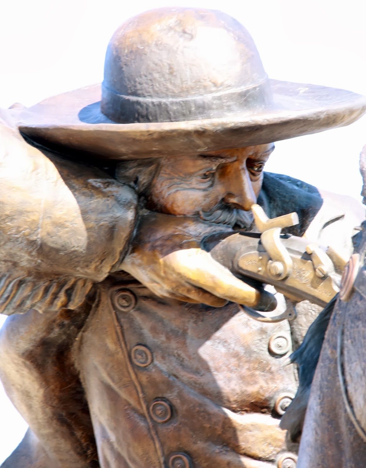
A native of Omaha, Nebraska, Jeff Barnes over the past few years has made a name for himself publishing a series of guidebooks on the Old West as well as traveling the Great Plains lecturing on the topic. Forts of the Northern Plains in 2008 came first, and told readers how to locate 51 forts in Iowa, Minnesota, North Dakota, South Dakota, Nebraska, Wyoming and Montana. Next came The Great Plains Guide to Custer: 85 Forts, Fights and Other Sites in 2011. On February 1, his publisher Stackpole Books will release The Great Plains Guide to Buffalo Bill. William F. “Buffalo Bill Cody” is associated with several sites along Highway 83, not the least of which is his home of about 16 years, Scout’s Rest Ranch in North Platte, Nebraska. Barnes in an email interview explains how the book came about/

SM: Tell us how you began specializing in writing guidebooks centered on Western history?
JB: I’ve always loved visiting the old forts and battlefields of the Indian wars, and had a little checklist to click them off as I did. Every time I stopped to see the Fort Sidney (Nebraska) site, however, it was closed. I first had an idea to create a list for my glove compartment of the sites I hadn’t seen yet, including their hours, directions and contact info, so I wouldn’t make a wasted trip. From that, I thought about making an expanded list for friends who shared my interest, and then it was just a short leap to think it might be a book.

SM: After writing guidebooks about forts of the Northern Plains and Lt. Col. Custer, you chose Buffalo Bill Cody? Why him? Why has he endured as such as popular figure in U.S. history?
JB: Actually, and this will sound goofy, but I was kind of looking for a sign on who to write about next. Buffalo Bill was one of about five topics I was considering, and I thought a 2012 road trip/speaking tour through Kansas might give time to sort it out. One of the stops was in Leavenworth, Kansas, and there on the wall of my motel room was a portrait of — you guessed it — Buffalo Bill. I called my editor the next day.
Bill Cody was a natural extension of the first two books – he was known at the forts and was a Custer contemporary.
I think he’s endured as a popular figure because he did so much to build his brand when he was alive. He was the one who had hundreds of dime novels and books published about himself, who advertised himself and his show and traveled and performed so extensively. He was a romantic figure who presented a very romanticized American West and successfully included himself as a major player in its history.  He used public relations incredibly well, and he was also a very attractive man whose broad Stetson, long hair and distinctive goatee were eye-catching. And he had a name you couldn’t forget either! It’s easily argued that he was the nation’s first superstar.

SM: Scout’s Rest Ranch in North Platte, Nebraska, is of course the most famous site on Highway 83 associated with Cody. What are some others that aren’t as well known? For example, I heard he once ran cattle north of the Dismal River?
Scout's Rest Ranch, North Platte, Nebr. Photos by Stew Magnuson
JB: His ranch on the Dismal with Frank North was farther to the west from Highway 83, about 65 miles to the northwest of North Platte near Tryon.
Easily visible from 83 to the north of Stapleton on the South Loup River, is the unmarked site of the 1872 skirmish with Sioux Indians [Lakotas] that resulted with Cody being awarded the Medal of Honor.
As you pass through Wellfleet, Nebraska, and cross Medicine Creek, you are very near the unknown site of where Cody, Custer, Gen. Phil Sheridan and Grand Duke Alexis of Russia took lunch and changed horses on their way to their campsite of the Grand Buffalo Hunt. That hunt is commemorated by a state historical marker near Red Willow Creek, between Highway 83 and Hayes Center.
 Across the border into Kansas, near the town of Traer [a few miles southwest of Cedar Bluffs] is a landscape formation called Elephant Rock. Cody was also involved with an Indian skirmish there while with the Fifth Cavalry in 1869.

SM: Oakley, Kansas, has a dramatic statue dedicated to Cody. What do we know about his time in that area?
JB: That statue is a commemoration of where Bill Cody “won” the name Buffalo Bill. A few miles west of Oakley on U.S. 40 is a depression in the ground where a supposed buffalo-shooting contest between Cody and Bill Comstock was held in 1868. Both had been nicknamed Buffalo Bill and this contest was to determine who owned the right to the name. Cody, of course, won. The story came out years after the event and after
Buffalo Bill memorial, Oakley, Kansas
Comstock was dead, leading to suspicions the story was created just to support the Buffalo Bill “legend” that was starting to grow. Decades later, broken remains of champagne and beer bottles were found at the site indicating a large number of people had been there to celebrate something!

SM: I’ve heard conflicting accounts of where the first Wild West Show was held. Was it North Platte or Omaha?
JB: Cody put together a show in North Platte in 1882 called the “Old Glory Blow-Out” to celebrate the Fourth of July. Judging from the response, Cody thought it might be something he could put on the road — he organized performers for rehearsals in Columbus, Nebraska, and in May 1883 in Omaha held the first production of the Wild West. So both towns, and maybe even Columbus, can claim being the birthplace.

SM: You have what is for some of us is a dream job traveling the West, checking out historic sites. What is next for you?
JB: I’m not sure. I’m still a freelance writer and have been approached about writing a book or two for an organization here in Nebraska. My publisher would like me to do a narrative on an historical character, yet unspecified, and I’d like to try that. But it will be something that I have a great deal of curiosity about — I can’t write about something I don’t care for. 

The Great Plains Guide to Custer is available at Amazon.com. Order HERE.


To join the Fans of U.S. Route 83 group on Facebook, CLICK HERE. And check out the U.S. Route 83 Travel page at www.usroute83.com.
 Stew Magnuson (stewmag (a) yahoo.com) is the author of Wounded Knee 1973: Still Bleeding: The American Indian Movement, the FBI, and their Fight to Bury the Sins of the Past published by the Now & Then Reader. It is available as an eBook on Kindle, Nook, Kobo and iTunes. Buy it in paperback on Amazon or bookstores such as Plains Trading Company Booksellers, in Valentine, Neb., on Highway 83.